Early Maps of Bryn Athyn, Pennsylvania, a New Church Community
Ed
and Kirsten H. Gyllenhaal
Portions
of some maps have been scanned by NewChurchHistory.org and are available here
in jpg or gif format. Some complete maps are available in Adobe Acrobat format
(pdf); these have been provided courtesy of Franklin
Maps in King of Prussia, PA. To view pdf files you need to have Adobe Acrobat
installed (you can download the program for free here).
The Old York Road Historical Society in Jenkintown, PA, is an excellent source
for early local atlases and maps: see their list
of property atlases and maps.
|
Atlas of the County of Montgomery and the State of Pennsylvania from actual
surveys & official records. Compiled and published by G.M. Hopkins (Philadelphia,
1871). | 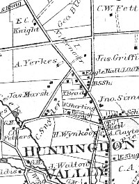 1871 |
|
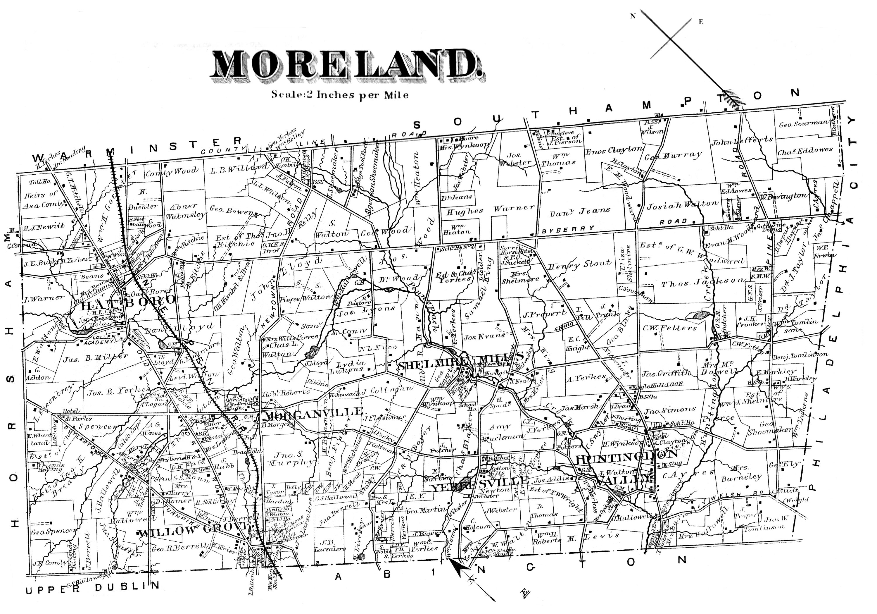
C.M. Hunter, Atlas of Boroughs & Towns in Philadelphia, Bucks and Montgomery
Counties on Line of North Pennsylvania R.R. and Branches, Bound Brook Railroad
to Langhorn, also Plans of Newtown & Hatboro. Published by J.D. Scott (Philadelphia,
1886), plate 17. | 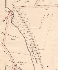
1886 |
|
Atlas of the Properties along the North Pennsylvania Bound Brook Pennsylvania
Railroads from Philadelphia to North Wales & Langhorne. Author: G. W.
Baist (Philadelphia: 1891), plate 15. | 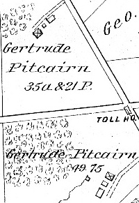
1891 |
|
Property Atlas of Montgomery County, Pennsylvania. Compiled by M. A. Naeff,
from Official Records, Private Plans, Actual Surveys. Author: M. A. Naeff,
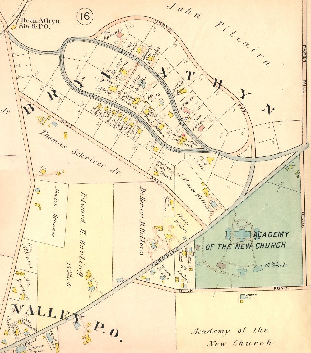
comp.; published by J. L. Smith (Philadelphia: 1893), plate 13. | 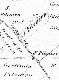 1893 |
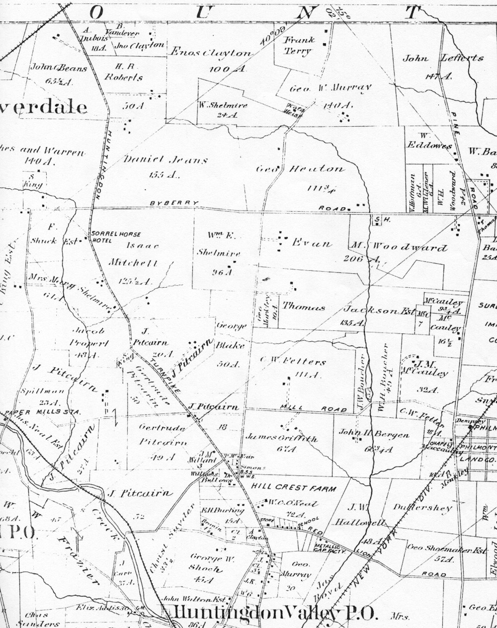
|
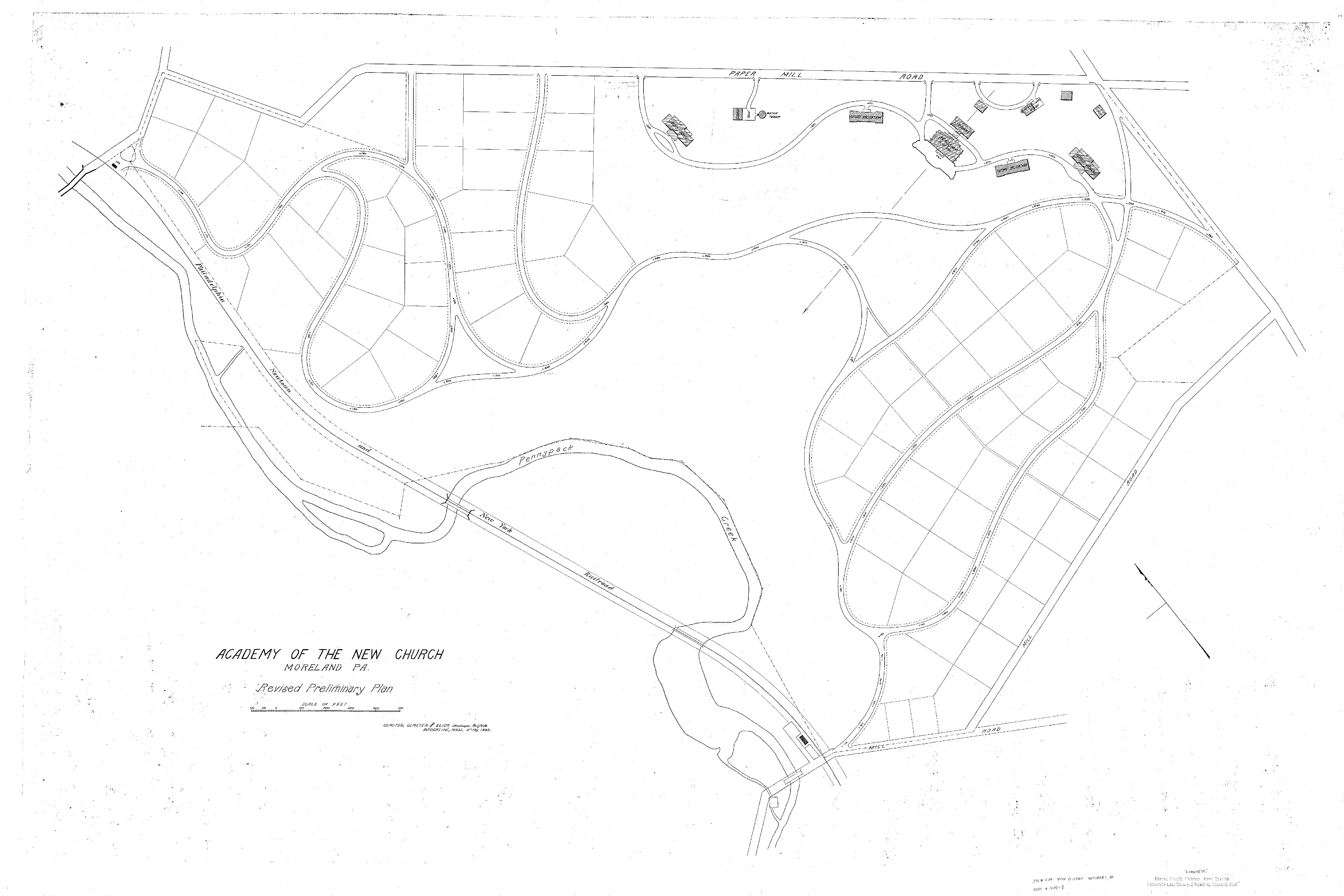
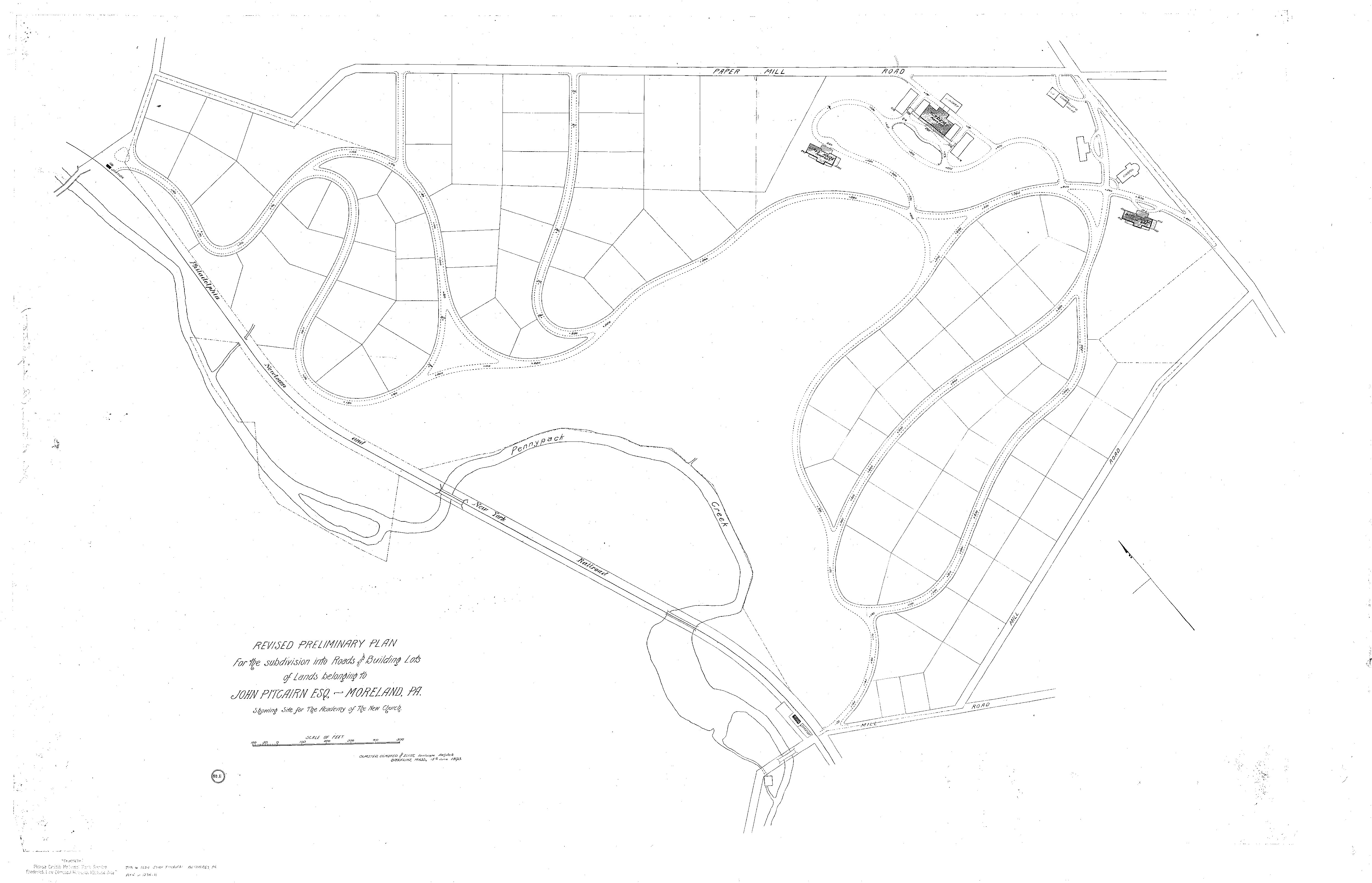
Academy of the New Church, Moreland, Pa., Revised Preliminary Plan, Olmsted,
Olmsted and Eliot, Landscape Architects, Brookline, Mass., 11th May 1893, 1234-8.
See also Revised Preliminary Plan for the Subdivision into Roads and Building
Lots of Lands belonging to John Pitcairn Esq., Moreland, Pa. Showing Site for
the Academy of the New Church, Olmsted, Olmsted and Eliot, Landscape Architects,
Brookline, Mass., June 15th, 1893, 1234-11. | 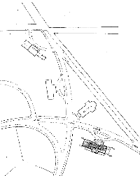 1893 |
|
Plan of lots laid out for John Pitcairn at Huntingdon Valley, Montgomery Co.,
PA. Scale – 1"-50'. Philadelphia, Jan. 7 1897, John H. Dye, Engineer & Surveyor.
|  1897 |
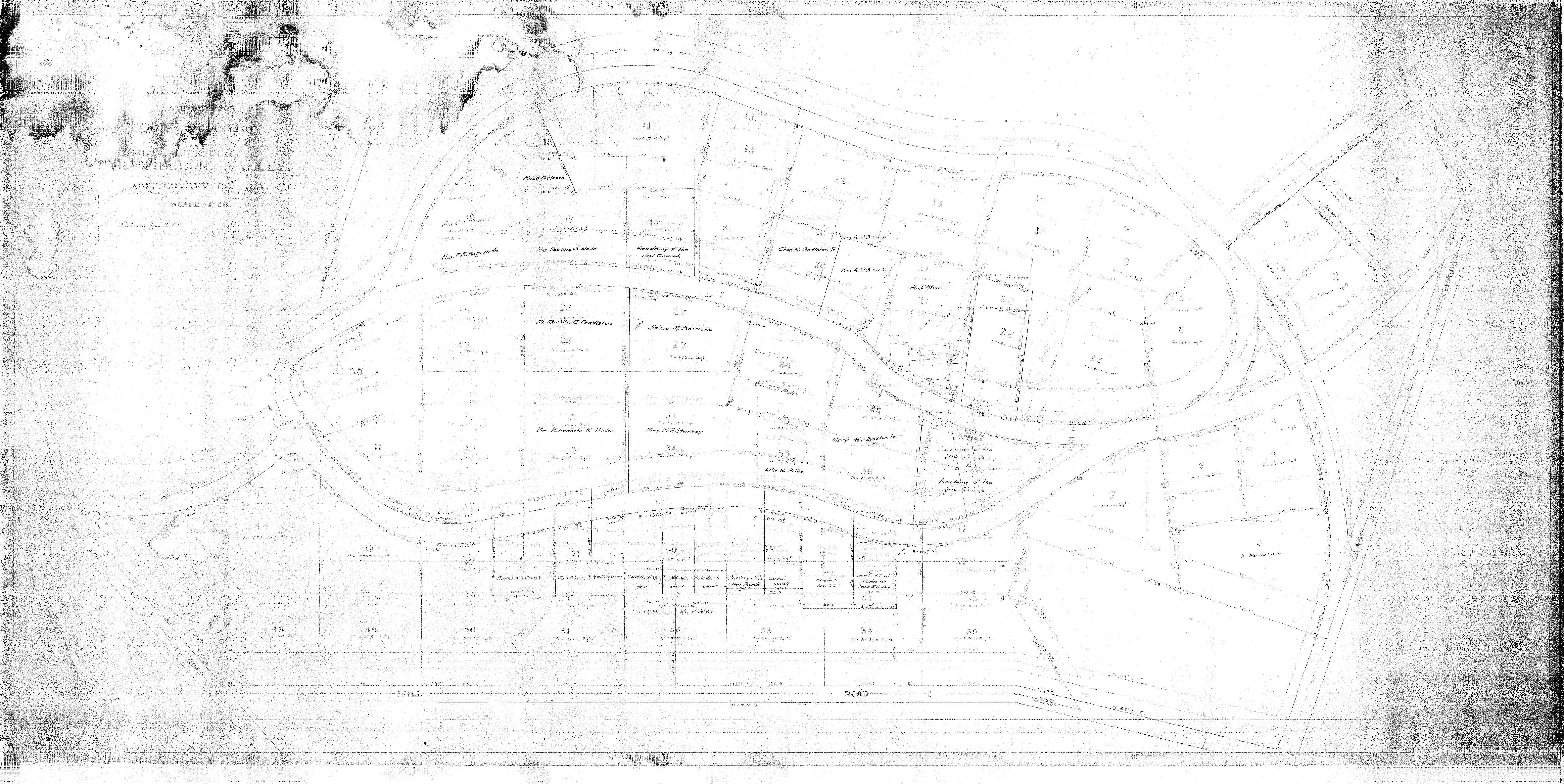
|
Academy of the New Church, Bryn Athyn, Pa. Preliminary Study Showing Proposed
Buildings and Roads, May 11, 1901. Warren H. Manning, Landscape architect, Boston
Mass. Plan No. 289-10. | 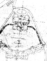 1901 |
|
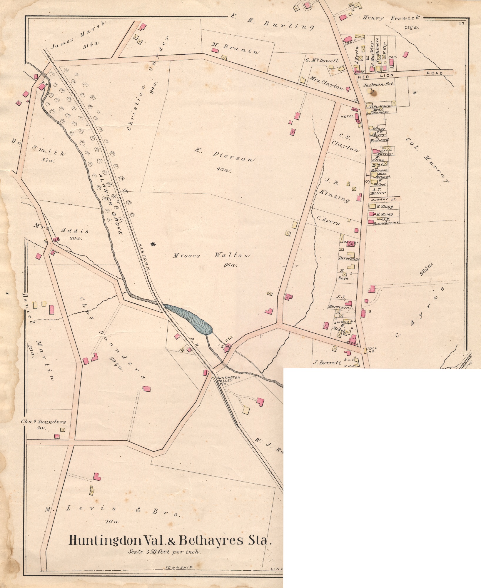
Atlas of the Properties on the Reading Railway Embracing Cheltenham, Abington,
Springfield and Parts of Moreland and Whitemarsh Townships. Plan of the Huntingdon
Valley Moreland Township. Author: A. H. Mueller (1909), plates 16 & 17. | 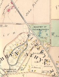 1909 |
|
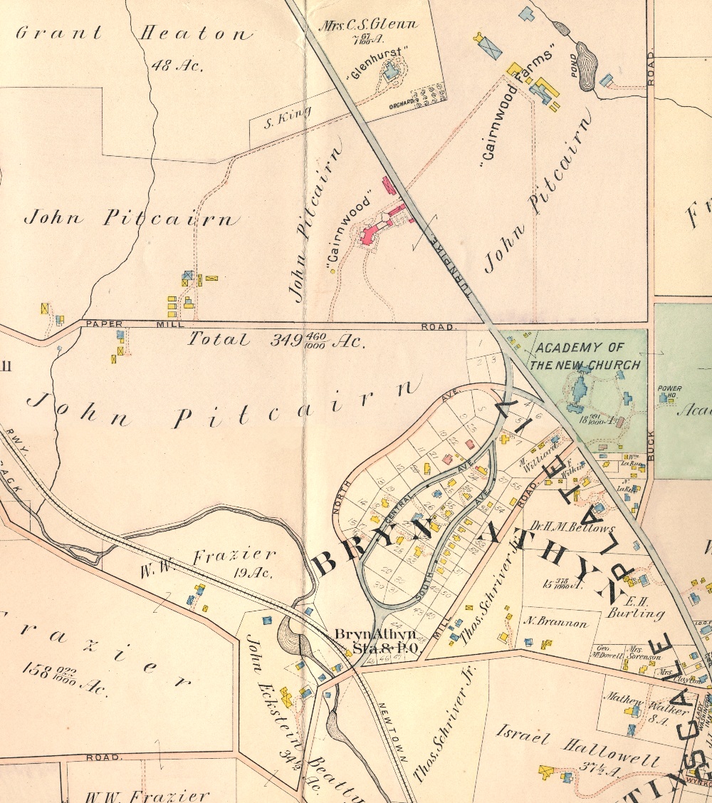
Atlas of the North Penn Section of Montgomery County, Penna., Embracing Cheltenham,
Abington, Springfield, Upper Dublin and Parts of Moreland, Whitemarsh, Whitpain,
Lower & Upper Gwynedd Townships. Author: A. H. Mueller (1916), plates 16 &
17. | 
1916 |
|
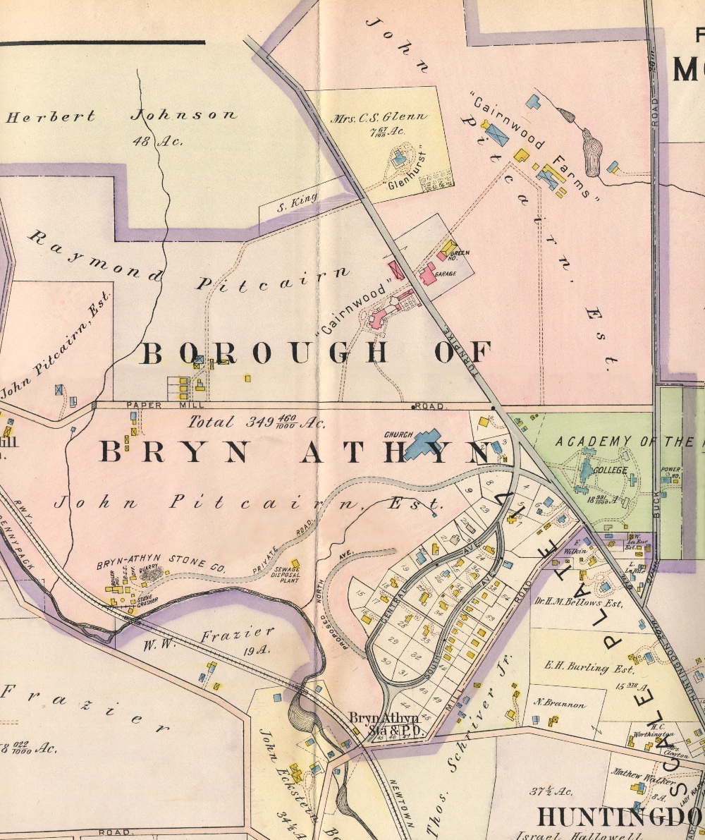
Property Atlas of Montgomery County, Penna., Volume A, Including the Townships
of Lower Moreland, Upper Moreland, Horsham, Montgomery, Lower Gwynedd, Upper Gwynedd
and the Boroughs of Bryn Athyn, Hatboro and North Wales. Published by Franklin
Survey Company, (Philadelphia, 1934), plate 1. |  1934 |
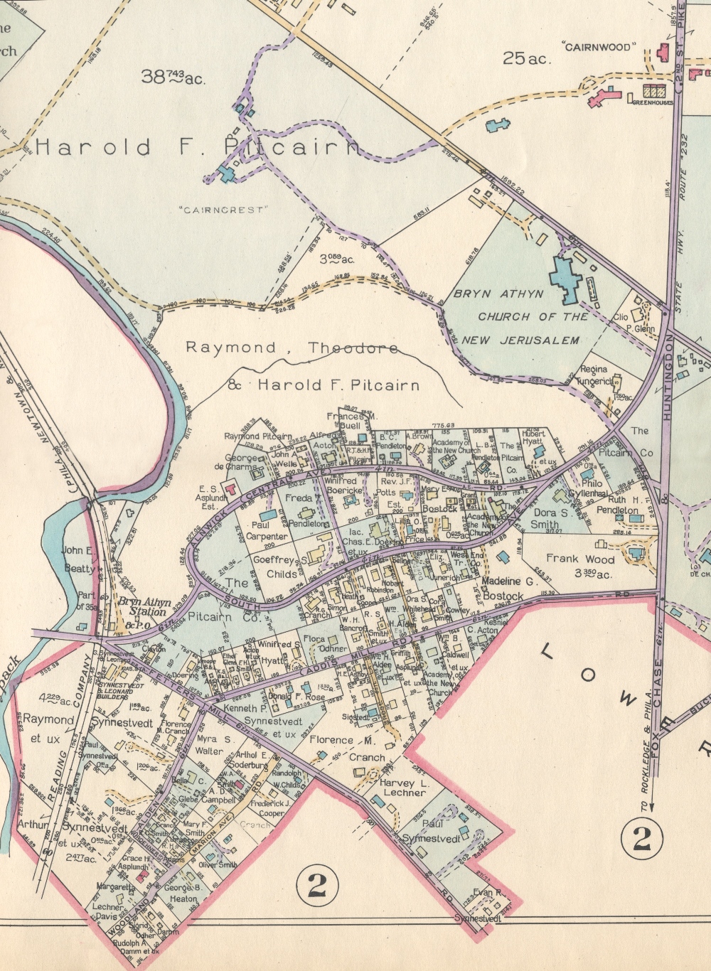
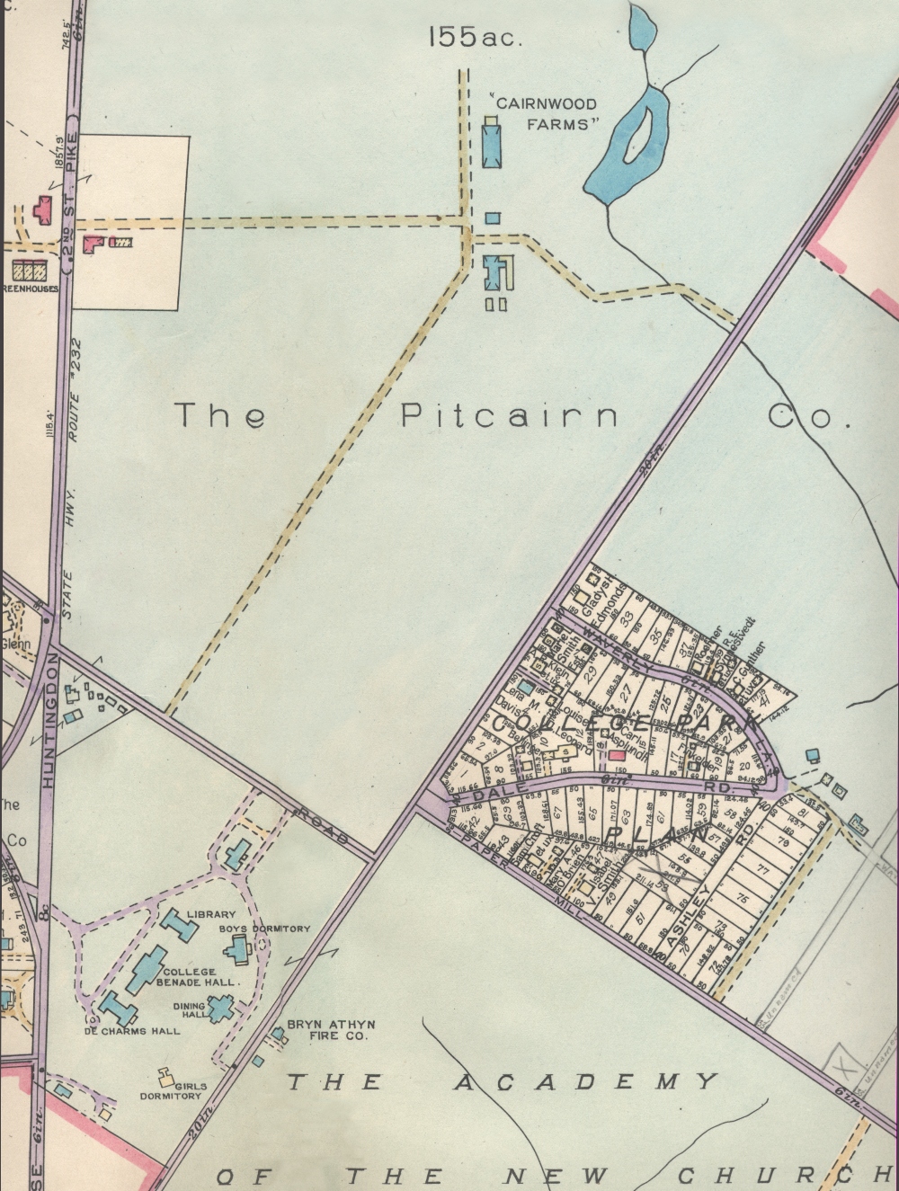
Revised 1/25/2006